
Sun Group proposed to build a 100 km long light rail line from Saigon to Tây Ninh
- 195
- Enterprise
- 11:29 17/10/2024
DNHN - Sun Group has submitted its recommendations to the People's Committee of Ho Chi Minh City regarding the draft plan for adjusting the general planning of Ho Chi Minh City up to 2040, with a vision extending to 2060.
Accordingly, Ho Chi Minh City needs to include in its planning a boulevard of 8-10 lanes running along the Saigon River, connecting with Bình Dương and Tây Ninh. The focal point is a light rail line directly connecting to Tây Ninh, facilitating trade between Ho Chi Minh City and Tây Ninh specifically, and the provinces along the Saigon River in general
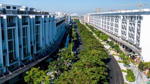
The light rail transit (LRT) line will run along the route next to the Saigon River, directly connecting to Tây Ninh with a length of nearly 100km, creating a continuous tourism development corridor, boosting the economic and social growth of the entire Southeast Region to match its potential.

Opening new development space for Ho Chi Minh City - Tây Ninh
According to the Draft General Planning Adjustment for Ho Chi Minh City up to 2040 with a vision to 2060, Ho Chi Minh City will have a 3-4 lane road along the Saigon River, with a total length of 78.2km.
However, to tap into future development potential, Sun Group proposes the need for a synchronized transportation network, with a boulevard of 8-10 lanes connecting Saigon with Bình Dương and Tây Ninh, running along the Saigon River, establishing deep connections with the Southeast provinces. Specifically, the route to Tây Ninh will follow Provincial Road 6 (in Ho Chi Minh City) heading towards Tây Ninh, then connecting to Provincial Road 789 (in Tây Ninh Province). This is part of National Highway 22C as per the regional transportation network development orientation for the Southeast Region for the period 2021-2030, with a vision to 2050.
Notably, the light rail transit (LRT) line running along the Saigon River will not stop at Củ Chi District as initially planned but will extend the entire route to Tây Ninh, nearly 100km long.
Thus, the light rail transit (LRT) line will add a new mode of transport (along with waterways and roads), completing the economic and tourism development corridor of the Southeast Region, expanding trade activities between Saigon and Bình Dương, Tây Ninh. This will help reduce the traffic pressure on the existing roads, alleviate congestion, and offer more choices for residents and tourists. Once operational, the new light rail line will connect Saigon with attractive destinations in Tây Ninh, such as Bà Đen Mountain, promoting the development of Tây Ninh tourism.
 viewed from the Dầu Tiếng Lake")
As an electric-powered transport, the light rail transit (LRT) is known as "green transportation", as it does not emit carbon emissions into the environment. It is a rapid transit system capable of facilitating and connecting with other road transport modes, ensuring ease of movement.
Mr. Hoàng Anh Tú - Project Director of BCG Vietnam Group - affirmed: “The investment in a 4-10 lane boulevard, including a mix of road and urban rail connecting Ho Chi Minh City through Củ Chi to Bà Đen Mountain, Tây Ninh, is essential to keep up with the trends of major urban developments worldwide. From there, it can open up new directions for tourism, urban, and commercial development, with a highlight on waterways, eliminating bottlenecks, and enhancing potential for Tây Ninh while improving the connection with Ho Chi Minh City.”
“A trump card” for Ho Chi Minh City to maintain its leading position in driving the Southeast Region's economy
According to architect Trần Ngọc Chính, former Deputy Minister of Construction - Chairman of the Vietnam Urban Planning Development Association, the development of a high-end tourism infrastructure axis, along with modern transportation infrastructure, including river, road, and rail running parallel, connecting from Ho Chi Minh City - Củ Chi - Bà Đen Mountain - Tây Ninh in the future Ho Chi Minh City planning draft will create a vibrant “on the water, under the bridge” space along the Saigon River corridor.
“If this economic axis is developed, it will solve traffic, logistics, and residential organization issues, forming an inter-regional tourism ecosystem, creating conditions for Tây Ninh to grow. This axis also passes through Bà Đen Mountain - the highest point in the Southeast Region. Therefore, this is not just an international economic link axis, but also needs to be a 'backbone' for tourism for Ho Chi Minh City.”
Besides proposing new transport infrastructure investments, Sun Group also contributed opinions on the development planning of culturally, touristically, and urban-rich potential areas of Saigon, such as: Rạch Chiếc Sports Complex, Cultural and Historical Park of Vietnamese Ethnic Groups (Thủ Đức City), Củ Chi Safari, ... and urban areas centered on the Saigon River such as: Thanh Đa Urban Area (Bình Quới, Bình Thạnh District), Trường Thọ Urban Area (Thủ Đức City), and urban areas along the Saigon River (Củ Chi District, Hóc Môn District) according to each subdivision.
Sun Group proposed that Ho Chi Minh City consider and incorporate these recommendations into the general planning. Sun Group’s proposals are expected to contribute to the development of Ho Chi Minh City, revitalizing the Saigon River, activating tourism potential, and affirming its position as the economic and social leader in the Southeast Region. The new ideas, when implemented, are anticipated to create new momentum for the comprehensive development of Ho Chi Minh City.
Anh Nguyen
Related news
#develop policies

What’s Vietnam’s game plan as President Trump pressures the Fed?
In a move that rattled political circles and financial markets worldwide, U.S. President Donald Trump declared he would sue Federal Reserve Chairman Jerome Powell for “stifling growth” with high interest rates.

Why is there a need for a development proposal in the field of cultural industries?
In the context of globalization and the booming creative economy, cultural industries are increasingly important in national development strategies. Vietnam needs a development proposal in this field to tap into its potential.
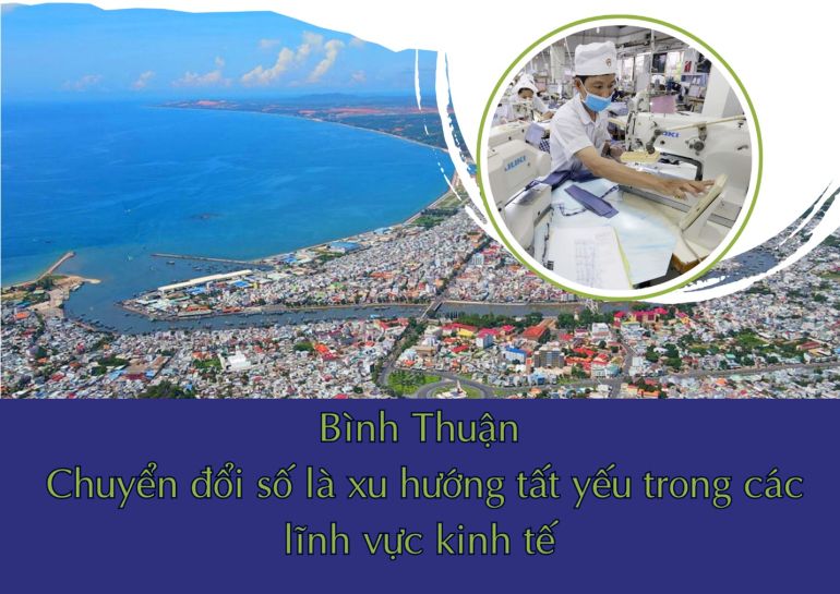
Digital transformation in Bình Thuận: An inevitable trend for economic development
Digital transformation is an inevitable trend, and Bình Thuận needs to accelerate the application of technology across various economic sectors.

FDI continues to flow strongly into real estate
Among investment sectors, real estate continues to attract significant FDI. This raises the question of why FDI continues to pour into this sector.
Vietnam will become a maritime power in 2045 for this reason
For Vietnam to become a strong maritime nation, wealthy from the sea as the Party and State have set out, many bold and synchronous solutions are being proposed.

Practical applications of carbon credits in the economy. Part XI: Bridging policy and strategy for the carbon credit market
To develop the carbon credit market, the Government and businesses must improve cooperation and communication. The Government needs to provide clear policies, while businesses must adopt emission reduction strategies and leverage carbon credits.
Đọc thêm Enterprise
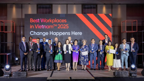
List of Vietnam’s 25 Best Workplaces 2025
Great Place To Work® has officially announced the 25 companies featured in the Best Workplaces in Vietnam™ 2025 ranking.
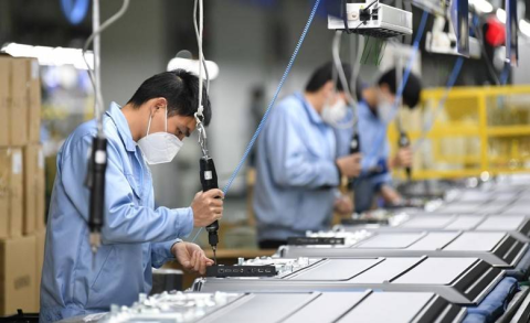
The ambitions of major enterprises in 2025
Major enterprises such as Dabaco, FPT, and KBC have set ambitious plans for 2025, demonstrating flexibility and sharpness in their business strategies.
What do domestic businesses need to overcome difficulties?
Strong and synchronized government support policies are crucial in helping Vietnamese enterprises navigate the current challenging period.
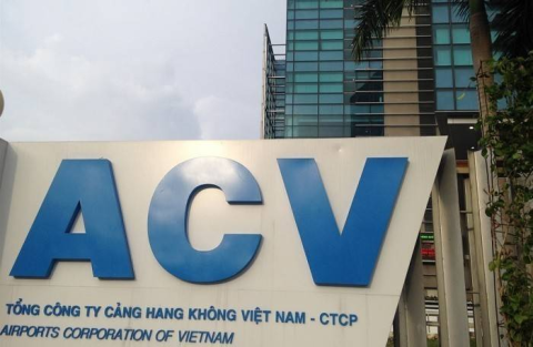
ACV achieved net profit surpassing VND 11,560 billion in 2024
Vietnam Airports Corporation (ACV) has recently announced its 2024 business results, reporting a net profit exceeding VND 11,560 billion, marking a 37% growth compared to the previous year.
Increasing taxes on pick-up trucks: The need to hear public opinion
The proposed tax increase on pick-up trucks is sparking debate. Many representatives argue that this decision could impact workers, businesses, and the domestic automotive market.

"The Vietnam-Korea Investment Cooperation Forum 2024 is a testament to the spirit of innovation and sustainable collaboration."
For Mr. Kim Ki-mun, Chairman of KBIZ, the Vietnam-Korea Investment Cooperation Forum 2024, scheduled for November 21, is not merely an event but also a testament to the spirit of innovation and sustainable collaboration between nations.
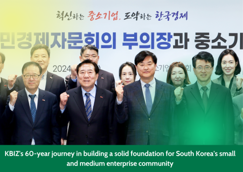
KBIZ's 60-year journey in building a solid foundation for South Korea's small and medium enterprise community
With over 60 years of establishment and development, the Korea Federation of SMEs (KBIZ) has emerged as a pioneering force in supporting the small and medium-sized enterprise (SME) community in South Korea.

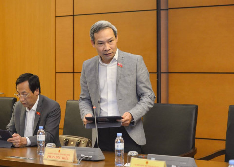
What categories are included in the additional audit subjects?
On the morning of November 7, the National Assembly discussed the draft amendment of several articles across seven laws, with a particular focus on adding new audit subjects.

Institutional obstacles "tie up" enterprises and challenge economic growth
During a session discussing the 2024 socio-economic development plan, National Assembly deputies emphasized that institutional barriers remain a significant "obstacle" for businesses.
More than 1,000 new real estate businesses established in Ho Chi Minh City, transactions grow
In the first nine months of 2024, Ho Chi Minh City's real estate market witnessed the establishment of over 1,000 new businesses and recorded 1,600 property transactions, signaling a positive recovery trend.